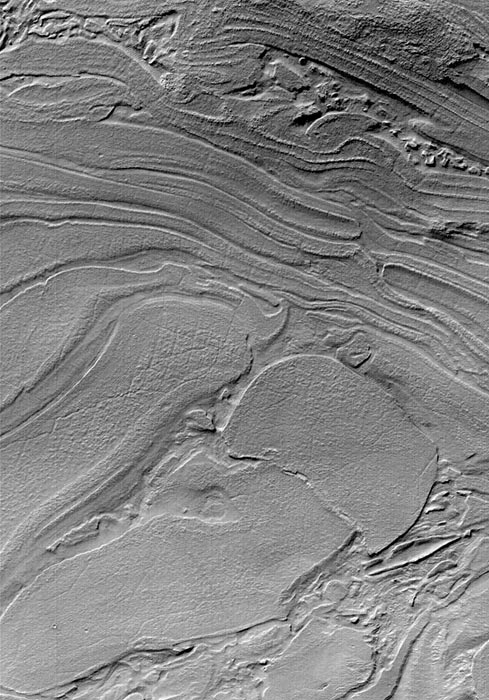
| Strange Surfaces of Hellas Planitia
Sometimes Mars Global Surveyor (MGS) Mars Orbiter Camera (MOC)
images show things that look very bizzare. Unique among the MOC
images is a suite of pictures from northwestern Hellas Planitia, such
as the example shown here. The seeming familiarity of many MOC
images, such as those showing earth-like sand dunes or stream-like
gullies might give the impression that it is pretty easy to understand
what MOC images are telling us about the geology of Mars. Indeed,
much of what has been found by MOC is both interpretable and
profound---layers recording the planet's early geologic history,
evidence for recent groundwater emerging at the surface, dust
storms and frost patterns that indicate seasonal change. Howver,
many martian landforms remain unexplained and may require years
of study. This picture, acquired in late October 2000, appears to be
a jumble of plates or layers exposed at the surface but subsequently
covered by a thin mantle to give the scene a uniform brightness.
What are these materials? Perhaps time and careful study will tell.
The picture is illuminated from the upper left and covers an area 2.9
by 4.1 km (1.8 by 2.5 mi) near 39.7°S, 306.7°W.
Photo Credit: NASA/JPL/Malin Space Science Systems
|