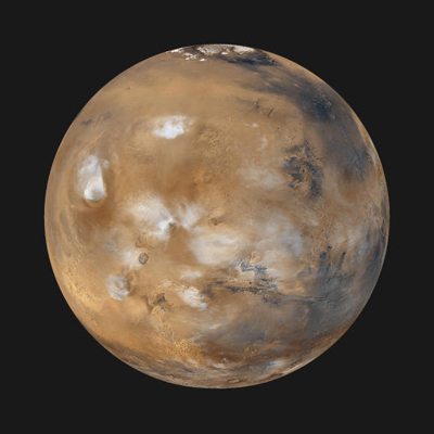
| Mars Daily Global Image from April 1999
Twelve orbits a day provide the Mars Global Surveyor MOC wide
angle cameras a global "snapshot" of weather patterns across
the planet. Here, bluish-white water ice clouds hang above the Tharsis
volcanoes. This computer generated image was created by wrapping
the global map found at PIA02066
onto a sphere. The center of this newly projected sphere is located at
15 degrees North, 90 degrees West. This perspective rotates the
south pole (which has no data coverage in the original map) away
from our field of view.
Malin Space Science Systems and the California Institute of
Technology built the MOC using spare hardware from the Mars Observer
mission. MSSS operates the camera from its facilities in San Diego, CA.
The Jet Propulsion Laboratory's Mars Surveyor Operations Project operates
the Mars Global Surveyor spacecraft with its industrial partner, Lockheed
Martin Astronautics, from facilities in Pasadena, CA and Denver, CO.
Photo Credit: NASA/JPL/Malin Space Science Systems
|